
Modern drones have evolved far beyond aerial photography applications. Today, they are effective tools for surveying, agriculture, infrastructure inspection, public safety, environmental monitoring, and logistics. While the aircraft provides flight capability, the true value of a drone is the equipment it carries and its drone payloads.
Table of Contents
The Technology That Gives Drones a Purpose
What makes the drone survey equipment, crop monitoring system, firefighting apparatus, or even an air delivery system?
A common misconception about unmanned aerial systems is that the drone is the primary element. In reality, the true value of any drone often lies in what it carries. That’s because attaching a professional camera can make it capable of creating topographical maps, while attaching a thermal camera can make it possible to detect heat leaks or missing persons or to inspect solar plants.
The aircraft provides flight. The drone payloads provide purpose.
Why a Drone Alone Isn’t Enough
Imagine buying the best drone that exists currently. It offers superior flight capabilities, efficient navigation technology, and high battery capacity. However, it won’t be able to map the land, inspect power lines, monitor crop fields, or conduct industrial surveys without the right drone payloads.
This is a common misconception amongst novice drone operators who usually concern themselves with flight performance but ignore the devices that actually collect the information.
For professionals, the drone payloads are frequently more important – and more valuable – than the aircraft itself.
To professionals, the drone payloads often have more value than the aircraft itself.
In some cases, a survey-grade LIDAR sensor or camera for mapping purposes may be significantly more expensive than the drone used to carry the payload since the quality of data depends on the payload itself.
What Is a Drone Payload?
A drone payload is defined as the equipment, sensor, camera, scanner, or any other instrument attached to a drone in order to complete the specific mission.
In other words, the drone is the platform while the payload is the instrument carried by the drone.
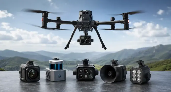
Common payloads include:
- RGB mapping cameras
- Thermal imaging sensors
- LiDAR scanners
- Multispectral cameras
- Agricultural spraying systems
- Searchlights
- Loudspeakers
- Gas detection sensors
- Cargo delivery mechanisms
Without a payload, the drone is just an aircraft. But with the right payload, the drone transforms into something special, which can help solve a lot of problems for us in real life.
For more insight into how drones utilize their components, such as motors, flight controllers, batteries, and navigational systems, one may check out our article, Inside Drone Anatomy – How Drones Work.
Why Drone Payloads Exist
The quick advancement of drone technology has created a need for a faster and cheaper process of acquiring data.
Conventional surveying involved hiring large numbers of field surveyors. Infrastructure inspections typically involved workers climbing towers or using helicopters. In agriculture, crop monitoring was achieved through manual labor-intensive field surveys.
The introduction of payload technology transformed everything.
By attaching specific sensors to drones, companies were able to collect accurate data from the air at lower costs, increased safety, and improved efficiency.
Currently, payloads for drones are used in
- Surveying and Mapping
- Agriculture
- Mining
- Construction
- Public Safety
- Utilities
- Environmental Research
- Logistics
- Defense
How Drone Payloads Work
Each payload is specifically designed to acquire, process, or transfer specific types of data.
The thermal sensor detects the presence of infrared radiation and displays the temperature variance.
The LiDAR sensor transmits multiple laser pulses in a second to create distance measurements and build up a three-dimensional image.
A multispectral camera inspects various wavelengths of light to measure vegetation health.
The collected data is sent to the operator via the drone’s communication system. Systems like DJI OcuSync have greatly enhanced the capability of transmitting live videos and sensor data effectively, allowing operators to get very clear and accurate observations from the output of the payload.
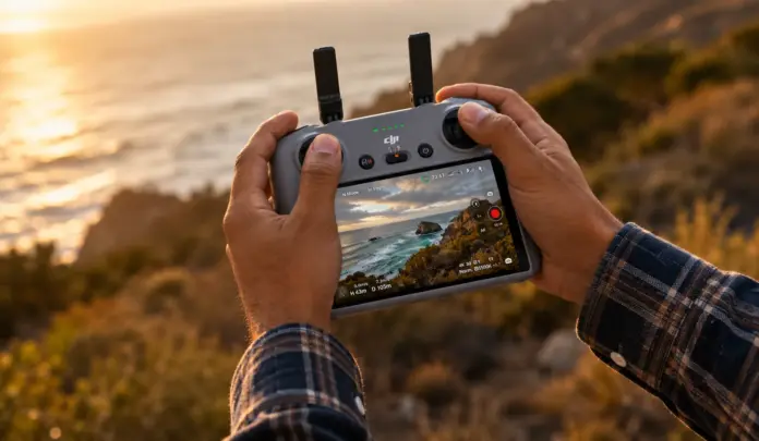
Similarly, the remote controller plays an important role in managing the payload. Users can adjust cameras, switch to thermal modes, focus on inspection targets, and regulate sensors right from the ground station.
Interested readers can refer to our article entitled “From Hands to Horizon – Drone Controller Explained.”
The Most Popular Drone Payloads Used Worldwide
RGB Mapping Cameras
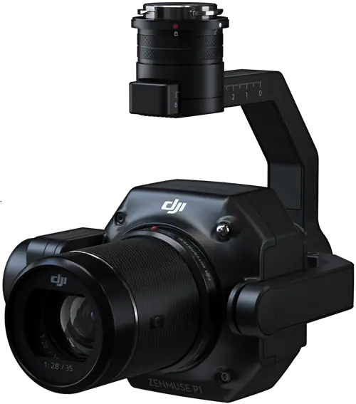
The RGB cameras continue to be one of the most widely utilized payloads in the drone industry.
Such cameras provide high-definition images that can be transformed into orthomosaic maps, three-dimensional models, and detailed inspection reports.
Why Users Care
RGB cameras are relatively inexpensive and flexible in use across numerous applications.
Applications
- Photogrammetry
- Construction progress monitoring
- Mining surveys
- Infrastructure inspection
- Real estate imaging
- Cinematography
Popular Examples
Common Drone Platforms
Thermal Imaging Cameras
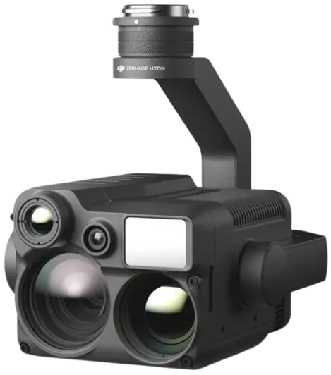
Thermal imaging cameras detect temperature changes that cannot be detected through traditional cameras.
Unlike traditional cameras that detect visible light, these sensors detect heat.
Why Users Care
This makes early problem detection possible and reduces the cost of maintenance and increases safety.
Applications
- Solar panels inspections
- Electrical infrastructure inspections
- Firefighting
- Search and rescue operations
- Wildlife monitoring
- Building diagnostics
Popular Examples
LiDAR Sensors
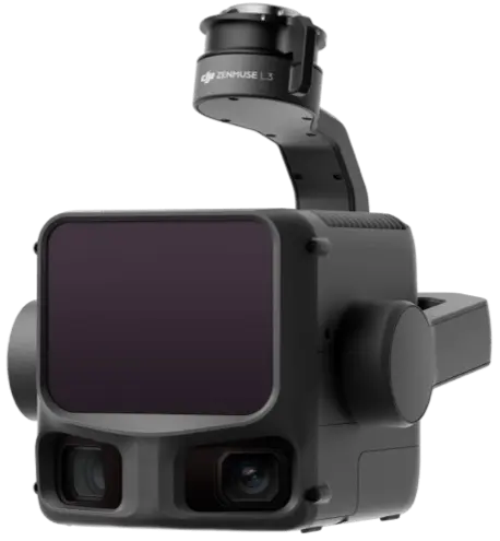
LiDAR has emerged as one of the most revolutionary payloads for drones within the surveying industry.
By using laser pulses to determine the distance, LiDAR devices can create extremely precise 3-D models of landscapes even in areas covered with dense vegetation.
Why Users Care
LiDAR significantly reduces survey time and improves accuracy.
Applications
- Topographic surveys
- Corridor mapping
- Forestry analysis
- Mining projects
- Utility inspections
Popular Examples
Multispectral Cameras
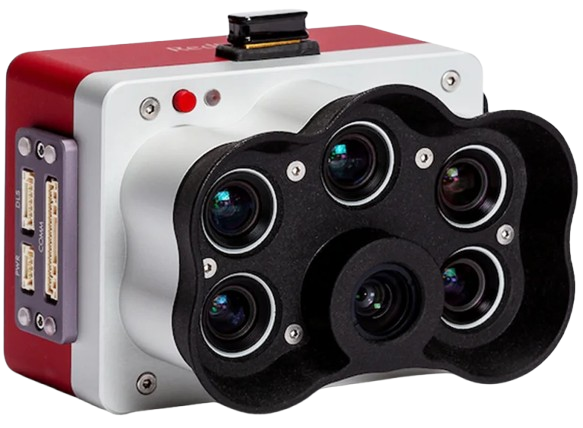
The multispectral payloads capture data from multiple light wavelengths, which cannot be seen by human eyes.
Why Users Care
This type of data provides great insights into the condition of crops and vegetation before any visible symptoms appear.
Applications
- Precision agriculture
- Forestry management
- Environmental studies
- Crop health monitoring
Popular Examples
Zoom Camera Payloads
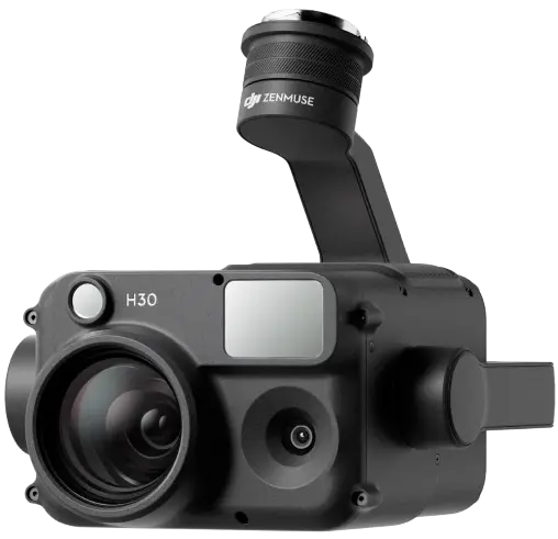
The zoom cameras help the user to view far-away objects without compromising image quality and resolution. Such payloads ensure safe inspection at a distance, eliminating the need for the drone to fly closer to any structure.
Why Users Care
The use of the Zoom camera payload ensures that operations conducted by the drones are safer because there is minimal need to get close to tall towers, electricity wires, windmills, and other sensitive infrastructure, but high-quality images will be taken.
Applications
- Power Line Inspections
- Telecom Tower Inspections
- Wind Turbine Inspections
- Security Monitoring
Popular Examples
Agricultural Spraying Systems
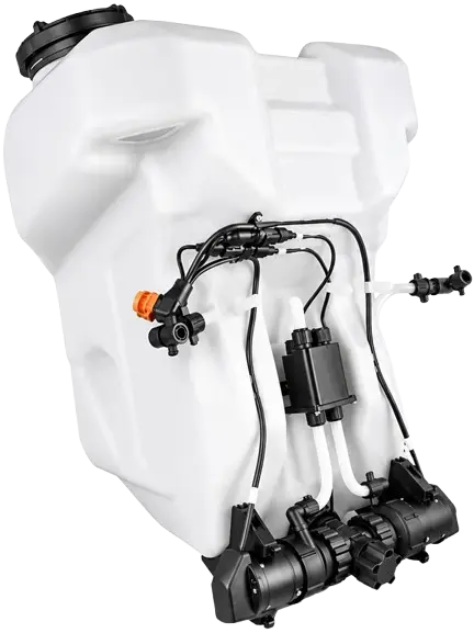
One of the most useful applications for drones has been agricultural spraying systems, which have transformed agriculture by allowing drones to spray pesticides, fertilizers, and herbicides to protect crops.
Why Users Care
Agricultural spraying drones help minimize chemical wastage, increase precision, cut down on labor needs, and make crop management easier.
Applications
- Pesticide Spraying
- Fertilizer Distribution
- Herbicide Application
Popular Examples
Loudspeakers and Searchlights
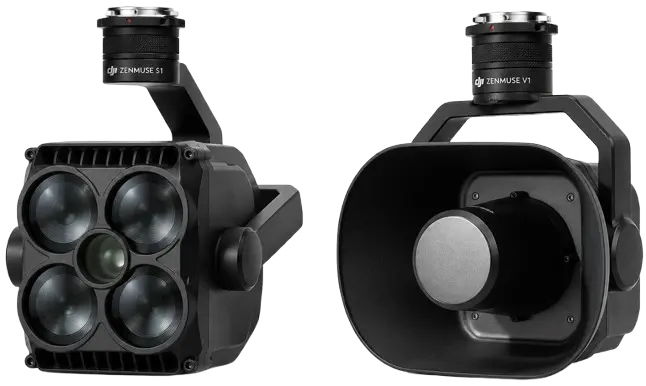
The payloads such as loudspeakers and searchlights are usually combined in operations that involve emergencies, ensuring public safety, and nighttime. The accessories improve the capabilities of drones in communicating and providing lighting where there is poor visibility.
Why Users Care
This kind of payload increases visibility and communication, hence improving the effectiveness of the missions conducted by these drones.
Applications
- Disaster Response
- Search and Rescue
- Public Safety Operations
- Nighttime Inspections
Popular Examples
Gas Detection Sensors
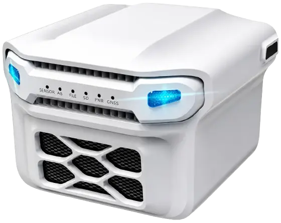
Gas detection payloads ensure that drones operate safely by monitoring and inspecting hazardous zones without putting workers at risk. The sensors can identify and quantify several types of gases, making them useful in providing safety and environmental data.
Why Users Care
The sensors contribute to ensuring worker safety through remote monitoring from safe zones, in addition to providing real-time environmental data.
Applications
- Oil and Gas Inspections
- Chemical Plant Monitoring
- Landfill Surveys
- Environmental Research
Popular Examples
Cargo and Delivery Systems
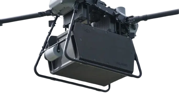
Transporting and delivery payloads are considered among the most rapidly developing segments within the drone industry. Transporting and delivery payloads allow drones to deliver cargo and other important items to places that might take considerable amounts of time and effort to reach.
Why Users Care
Rapid delivery of critical supplies is possible with delivery payloads, helping organizations boost efficiency, cut down delivery times, and support emergency response operations.
Applications
- Medical Deliveries
- Emergency Logistics
- Industrial Transport
- Parcel Delivery
Popular Examples
Real-World Impact of Drone Payloads
The influence of payload technology can be seen almost everywhere among major industries. By loading drones with specialized sensors and mission-specific equipment, the data collection process becomes faster, safer, and more effective.
The surveyor utilizes LiDAR scanners and mapping cameras for producing accurate digital elevation models and topographical maps. The farmer utilizes multi-spectral sensors and agricultural sprayers to maintain the growth of crops and increase yield. The emergency responder makes use of thermal cameras, loudspeakers, and search lights for carrying out search-and-rescue operations.
The utility companies use zoom cameras and thermal imagers to conduct inspections on power lines, substations, and critical infrastructure, making it unnecessary to have people do this in risky conditions. Although drones offer mobility across sectors, the real intelligence is provided by the payload carried by these aircraft.
What Comes Next?
Drone payload technology continues to evolve at an amazing speeds. With advancements made in sensors being more compact, lightweight, and smarter, drones will be capable of handling much more complicated missions in the future.
Expected future developments in drone payloads will include the following:
- AI-Powered Edge Computing Sensors
- Advanced Hyperspectral Imaging Systems
- Compact Synthetic Aperture Radar (SAR)
- Autonomous Inspection Payloads
- Real-Time 3D Mapping Solutions
- Enhanced Environmental Monitoring Sensors
With the development of payloads and their integration with onboard processors, drones will continue to grow into various fields, offering increased efficiency, accuracy, and automation.
The Real Power Is Below the Aircraft
Whenever one thinks about drones, they tend to consider flight performance, batteries, and range. However, the real capability of the drone lies with its payload.
Regardless of whether this technology is a mapping camera, thermal sensor, LiDAR scanning system, multispectral camera, cargo delivery system, or an advanced inspection system, it is this technology that makes the drone into an effective professional tool.
The continued adoption of drones around the world means that payload technology will continue to drive innovation in the industry. Such technologies are making things safer for inspections, more efficient for farming, more accurate for surveys, quicker for emergencies, and possible where they were never before feasible.
Remember that when you witness a drone performing its task, the most critical technology may not be the drone itself but rather the payload beneath it.
| Disclaimer: This article is for educational and informational purposes only. The drone payloads, sensors, and products mentioned are provided as examples and may vary in specifications, compatibility, and availability. Always verify technical details and comply with applicable drone regulations before purchasing or operating any equipment. The author and publisher are not responsible for any decisions, losses, or damages resulting from the use of information presented in this article. |